Utah: two storms before Alta, Park City and Solitude open on 20 November
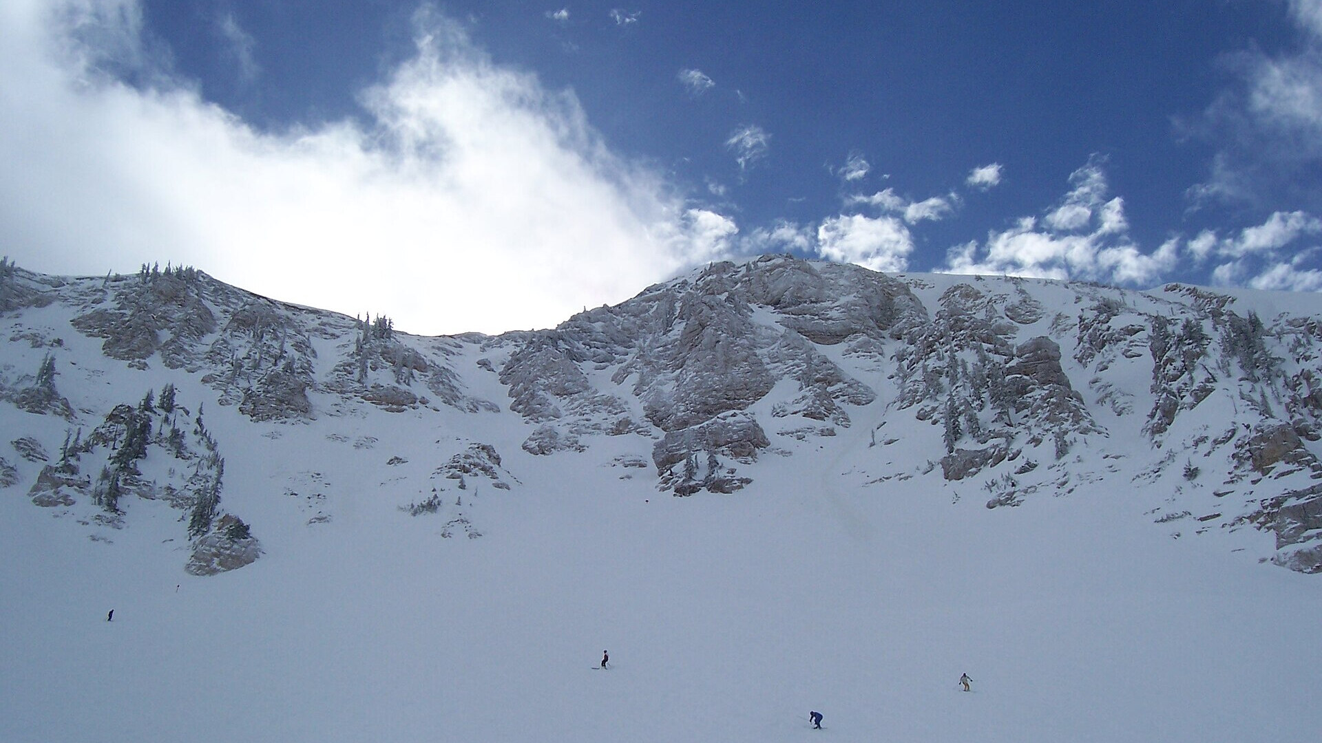
Skiers below the Baldy Chutes at Alta, Utah. Photo: Baileypalblue via Wikimedia Commons, public domain
Two storms reach Utah's mountains on Tuesday 17 November and from Thursday 19 to Friday 20 November 2026, the National Weather Service in Salt Lake City forecasts. The second storm is colder and may bring the first snow to the valley floors. Alta, Park City Mountain and Solitude plan to open on Friday 20 November, conditions permitting. As of Saturday 14 November, Alta had a base of 21 inches.
In short
- First storm: late Monday 16 to Tuesday 17 November, with snow above 8,000–9,000 ft at first.
- The weather service's point forecast near Alta gives 7–11 inches on Tuesday and 5–9 inches on Tuesday night.
- Second storm: Thursday 19 to at least Friday night 20 November, colder and longer, with more snow for all Utah mountains.
- Salt Lake City has a 90 % chance of its first freeze of the season on Wednesday morning 18 November.
- Alta, Park City Mountain and Solitude target 20 November; Snowbird and Snowbasin target 27 November.
Two storms in four days
"A cold system rich with Pacific moisture will bring widespread rain and mountain snow to the region late Monday through Tuesday," the National Weather Service in Salt Lake City wrote in its forecast discussion on the night of Sunday 15 November. The main band of rain and snow arrives on Tuesday morning, and a cold front follows in the late afternoon.
The snow line starts high. It stays at about 8,000 to 9,000 ft for most of the first storm and drops to about 5,500 to 6,000 ft behind the cold front on Tuesday evening. Wednesday brings a short dry break.
The second storm starts early on Thursday 19 November and lasts at least until Friday night. The weather service calls it colder and longer, with more snow for all Utah mountains. About 20 % of the forecast models bring the snow line close to the valley floors on Thursday night; by Friday morning the models agree on air cold enough for snow near or below the valley floors.
| When | Forecast (NWS Salt Lake City) |
|---|---|
| Mon 16 Nov, evening | showers start in south-west Utah |
| Tue 17 Nov | rain and mountain snow; cold front late afternoon; snow line 8,000–9,000 ft, then 5,500–6,000 ft |
| Wed 18 Nov | dry break; 90 % chance of the first freeze in Salt Lake City |
| Thu 19 – Fri 20 Nov | colder, longer storm; more snow for all mountains; light snow possible down to 5,000 ft late Friday |
| Sat 21 Nov | coldest temperatures of the season so far |
How much snow
The weather service gives no storm total for the Wasatch yet. Its point forecast for the terrain near Alta, at about 9,800 ft (2,990 m), gives these amounts, all forecasts:
| Period | New snow near Alta (forecast) |
|---|---|
| Tuesday 17 Nov, day | 7–11 in |
| Tuesday 17 Nov, night | 5–9 in |
| Thursday 19 Nov, day | 3–7 in |
Other forecasters give bigger totals for the whole week. KSL reported on 13 November that some long-range models showed several feet for Utah's mountains by the end of a three-storm cycle. The Park City news site TownLift wrote on 13 November that a University of Utah model gave a good chance of nearly 3 ft by Saturday 22 November. Teton Gravity Research cited an OpenSnow forecast of about 3 ft for Snowbird from 17 to 21 November. These figures come from models and can still change a lot.
The only winter weather advisory in force on Sunday night covered Utah's southern mountains, with 5–10 inches above 8,000 ft on Monday night and Tuesday. There was no advisory for the Wasatch at that time.
Which resorts open when
The storm of Saturday 14 November gave Alta 5 inches in 24 hours, a base of 21 inches and 29 inches for the season, Teton Gravity Research reported. These are the planned opening dates, all "conditions permitting":
| Resort | Planned opening |
|---|---|
| Alta | Friday 20 November |
| Park City Mountain | Friday 20 November |
| Solitude | Friday 20 November |
| Snowbird | Friday 27 November |
| Snowbasin | Friday 27 November |
| Sundance | Friday 4 December |
| Deer Valley | Saturday 5 December |
Brighton gives no date yet. Eagle Point will not open this season because of the Cottonwood Fire, TownLift reported on 6 November. Check each resort's own page before you travel, because opening dates can move with the snow.
What this means for your skis
The first days will mix new snow on top with a thin base below. An all-mountain ski of about 99–100 mm floats in a few inches of fresh snow and still holds an edge on the groomed opening runs.
| Ski | Waist | Radius (length) |
|---|---|---|
| Nordica Enforcer 99 | 99 mm | 18 m (179 cm) |
| Black Crows Vena Cor | 100 mm | 17 m (174 cm) |
| Salomon QST 100 | 100 mm | 18.5 m (188 cm) |
The figures are the makers' own; we compare them, we do not ski the products. To find the right ski for your level, use the Pick-a-Ski ski finder.