70 cm of snow on the Kitzsteinhorn: the Alps turn white on 22 October
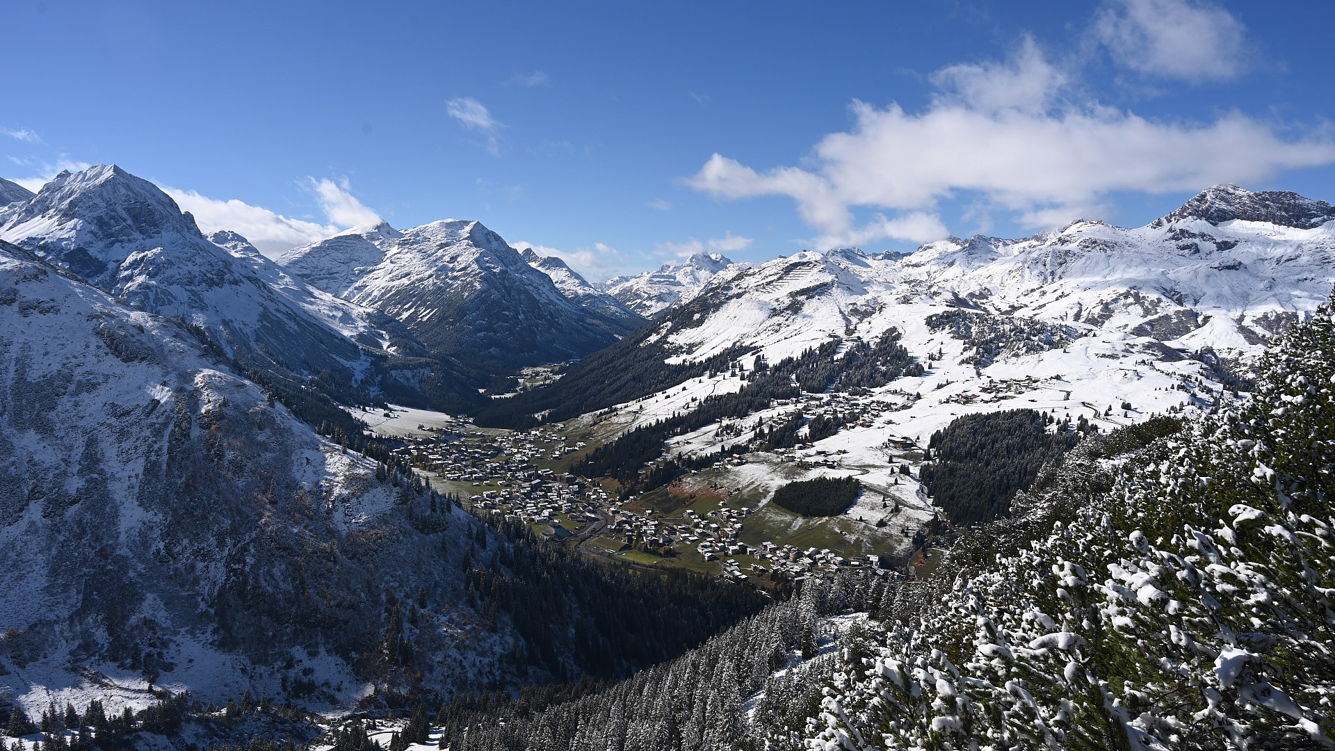
Photo: Lech am Arlberg, 22 October 2026, 13:00 — www.foto-webcam.eu
In short
- A cold front crossed the Alps on Wednesday 21 October. By Thursday morning snow lay in ski villages from the Arlberg to the Ötztal.
- The Kitzsteinhorn reports 70 cm on the glacier at 3,029 m and 40 cm at the Alpincenter at 2,450 m. Hintertux and Stubai report 15 to 20 cm of new snow.
- Eight glacier areas are skiing this week. The World Cup opens in Sölden on Saturday 24 October.
- More snow is forecast for Friday and the weekend, with a snow line between 1,600 and 1,800 m.
What fell where
The first real winter front of the season came from the west on Wednesday. MeteoSwiss measured 37 mm of precipitation on the Säntis on 21 October at an average temperature of −0.9 °C, and 23 mm on the Weissfluhjoch above Davos. Across the border, GeoSphere Austria's station on the Sonnblick at 3,109 m went from 0 cm on Wednesday morning to 34 cm on Thursday morning. In Obergurgl at 1,941 m the snow depth peaked at 12 cm at half past two in the night and had melted to 5 cm by Thursday afternoon.
Lower down, the snow mostly fell on grass and did not last. The GeoSphere station in St. Anton at 1,304 m recorded no measurable snow depth, even though the slopes above the village were white at nine in the morning.
The official snow reports of the glacier ski areas on Thursday 22 October:
| Ski area | Snow depth | New snow | Open |
|---|---|---|---|
| Kitzsteinhorn | 70 cm at 3,029 m, 40 cm at 2,450 m | — | 9 lifts, skiing down to the Alpincenter |
| Hintertux | up to 25 cm at 3,250 m | 15 cm | 8 lifts, 22 km |
| Stubai | 15 cm at 3,000 m | 20 cm | 12 of 25 lifts, 8 of 40 runs |
| Sölden | 0 to 48 cm | — | 8 of 31 lifts, 24 of 147 km |
| Kaunertal | 15 cm at the Karlesjoch | 15 cm in 24 h | open since 17 October |
| Pitztal | 15 cm at 3,440 m | 5 cm | glacier open |
| Zermatt | 30 cm at Matterhorn Glacier Paradise | — | 1 lift, glacier runs closed on Thursday |
| Saas-Fee | — | — | closed on Thursday for avalanche blasting and piste preparation |
The depths are per ski area and per station, as published on the resort websites on 22 October. Sölden publishes a range for the whole area.
The pictures
The webcams of foto-webcam.eu show the morning after. In Oberlech, at 1,556 m, the roofs were white at nine o'clock.
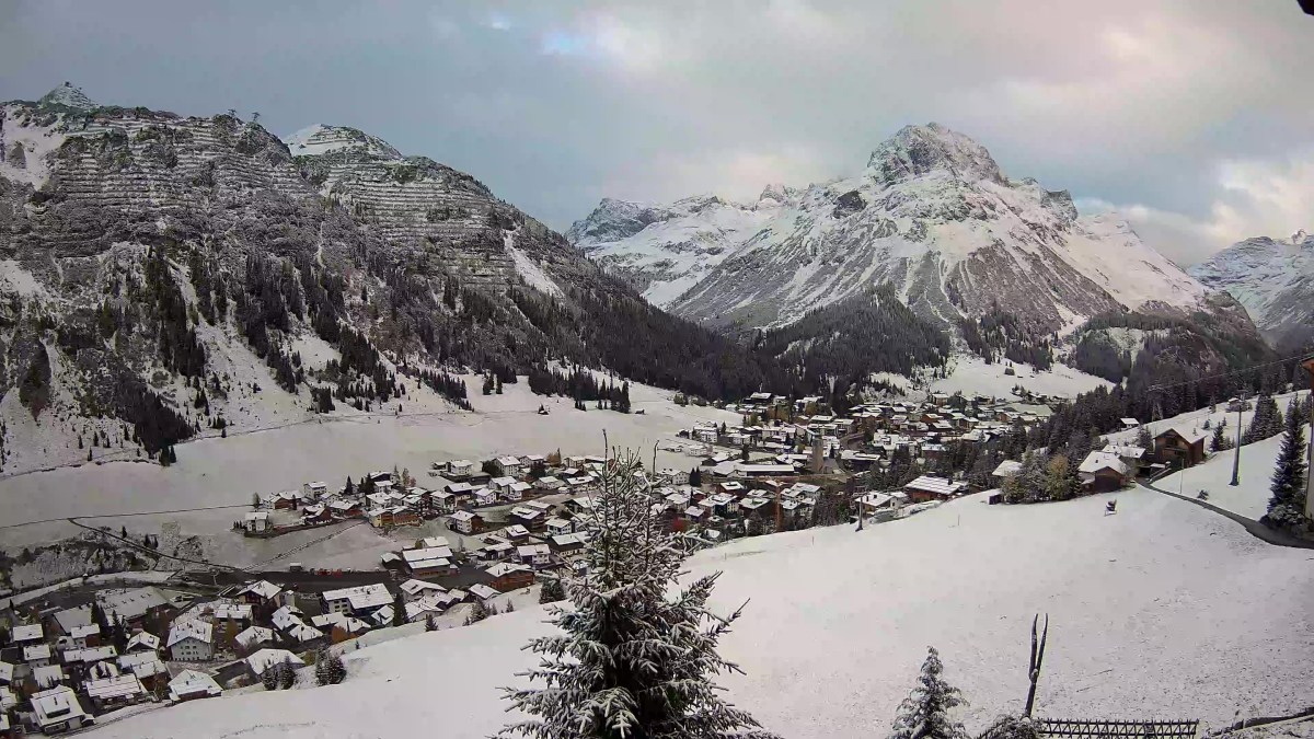
Oberlech, 22 October 2026, 09:00 — www.foto-webcam.eu
At the Galzig top station above St. Anton, at 2,090 m, the pistes were covered by midday. The Arlberg lifts do not run yet, so this snow is for the groomers, not for skiers.
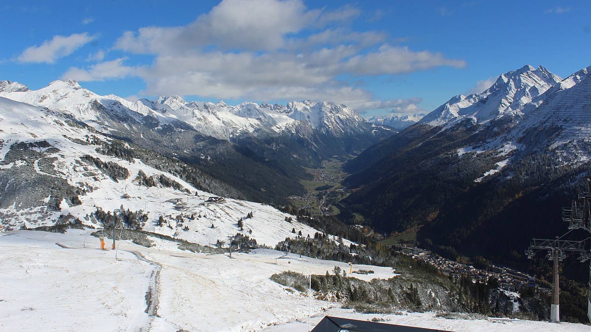
St. Anton am Arlberg, Galzig, 22 October 2026, 13:00 — www.foto-webcam.eu
In Germany the Nebelhorn above Oberstdorf, at 2,224 m, was fully white, while the Allgäu valleys stayed green.
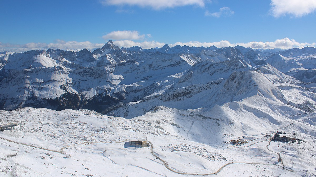
Nebelhorn, Oberstdorf, 22 October 2026, 13:00 — www.foto-webcam.eu
In the Montafon, the Kristallbahn base station in Gargellen at 2,027 m looked ready for December.
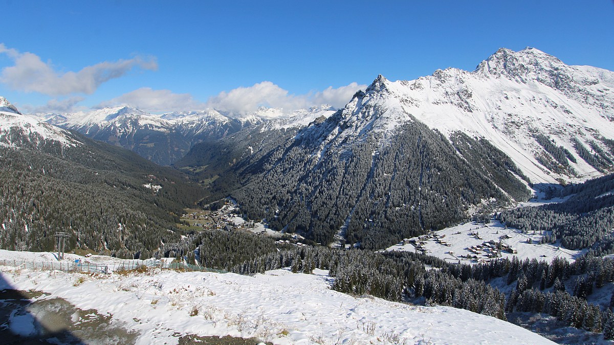
Gargellen, Kristallbahn, 22 October 2026, 13:00 — www.foto-webcam.eu
Is this early?
Not really. GeoSphere Austria's climatologist Alexander Orlik said after a similar event last year that winter weather like this "is typical for mid- to late October and occurs about once every one to two years" (GeoSphere, November 2025). MeteoSwiss notes that above 1,500 m it snows on half of all October days, and that at the end of October 1974 Arosa already had more than 70 cm (MeteoSwiss blog).
What is unusual this year is the contrast. Zermatt had announced public glacier skiing from 14 October, but on Thursday evening all glacier runs were still closed. Titlis opens its glacier on 29 October.
The weekend
The World Cup season opens on the Rettenbach glacier in Sölden with the women's giant slalom on Saturday 24 October and the men's on Sunday 25 October (FIS). The race piste was approved on 15 October, built on 60,000 m³ of snow stored since spring.
The forecasts agree on more snow. The South Tyrol weather service expects a south-westerly flow on Friday with a snow line between 1,600 and 1,800 m (bulletin of 22 October). Météo-France expects snow in the northern French Alps from 1,700 m on Friday afternoon (Alpes du Nord). Sunday looks unsettled again on the Alpine main ridge.
What this means for your skis
Early-season snow on a glacier is thin, hard and mixed with stored snow from last spring. Stubai and Hintertux both describe the surface as "hard". That is piste-ski terrain: a narrow waist, a short radius and a stiff tip hold an edge on it. A wide freeride ski with a lot of rocker is the wrong tool this week. It will come into its own when the villages have 50 cm, not 5.
If you want to ski a glacier in the next two weeks, take your carving or all-mountain skis with a waist of 70 to 85 mm. Our ski selector ranks the current catalog on piste grip, and the all-mountain reviews show which models keep a calm edge on hard snow.
Sources: the resort snow reports linked in the table, GeoSphere Austria TAWES station data, MeteoSwiss daily station data (Säntis, Weissfluhjoch, Davos), the South Tyrol weather service, Météo-France and FIS. All figures as published on 22 October 2026.