Colorado snowpack at 125 % on 3 November: where the Halloween storm landed
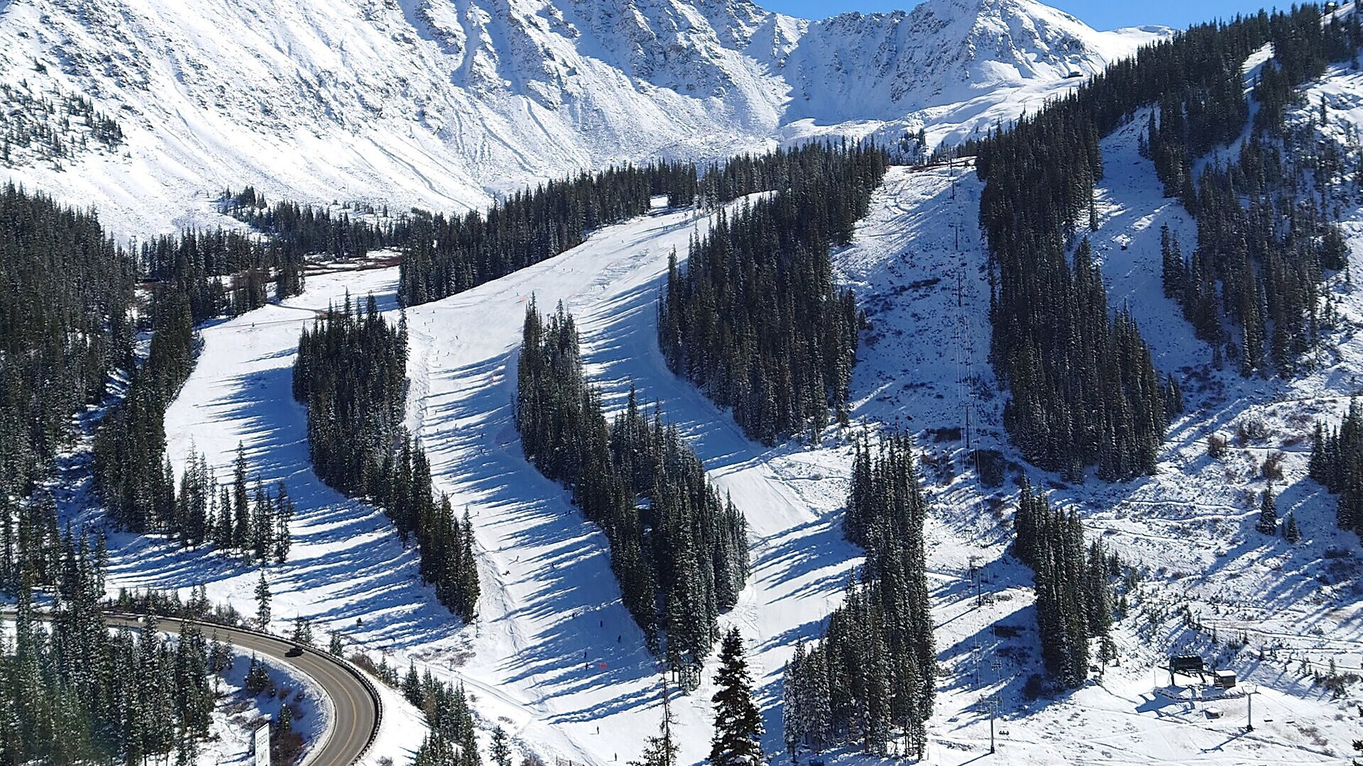
The base of Arapahoe Basin five days after an opening in late October, here on 28 October 2022. Photo: Runningonbrains via Wikimedia Commons, CC0, cropped.
Colorado's statewide snowpack stood at 125 % of the median on Tuesday 3 November 2026, two days after it read 82 %, according to the SNOTEL stations of the US Natural Resources Conservation Service. The Halloween storm of 31 October to 2 November did that in 48 hours. The number is real but fragile: the median for 3 November is 0.98 inch of water, so one storm moves it by tens of points. The gains sit in the south and west; the Front Range basins stay at a third of normal.
In short
- Statewide snow-water equivalent on 3 November: 1.23 inches against a median of 0.98 inch, or 125 %; on 1 November it was 82 %.
- The Yampa and White basin around Steamboat jumped from 17 % on 1 November to 81 %; the San Juan basins stand at 406 %.
- The South Platte basin, home to Loveland and Eldora, is at 33 %; the Upper Colorado around Vail and Summit County at 75 %.
- Wolf Creek counted 12 inches from the storm and 39 inches this season, but stays closed while Archuleta County's evacuation orders hold.
- The next storm brings 2 to 5 inches on Wednesday night 4 November; after that the forecasts see dry weather until mid-November.
125 % of a very small median
The NRCS basin plots measure the water held in the snow at the SNOTEL sites, as a share of the 1991–2020 median for the date. On 27 October Colorado read 132 %, on 1 November 82 %, on 2 November 104 % and on 3 November 125 %. A median under one inch of water turns a single storm into a large percentage.
The agency marks almost every basin with an asterisk: the analysis may not give a valid measure, because more than half of the stations have no snow or no median yet. Gillian Harrison, meteorologist at the National Weather Service in Grand Junction, said it to the Durango Herald on 30 October: "This early in the season, sometimes it doesn't take much to go above that median."
Basin by basin
| Basin (resorts) | 27 October | 1 November | 3 November |
|---|---|---|---|
| Colorado statewide | 132 % | 82 % | 125 % |
| Yampa / White (Steamboat) | 30 % | 17 % | 81 % |
| Upper Colorado (Vail, Summit County, Winter Park) | 55 % | 36 % | 75 % |
| South Platte (Loveland, Eldora) | 42 % | 26 % | 33 % |
| Gunnison (Crested Butte) | 261 % | 150 % | 219 % |
| Arkansas (Monarch) | 164 % | 90 % | 112 % |
| Upper Rio Grande (Wolf Creek, east side) | 565 % | 295 % | 299 % |
| San Juan / Dolores / Animas (Telluride, Purgatory) | 600 % | 301 % | 406 % |
Source: NRCS basin plots, snow-water equivalent as a percentage of the 1991–2020 median, files of 3 November 2026.
The pattern follows the storm track. The moisture came from the south-west and fell hardest on the San Juan Mountains, where the same system flooded Pagosa Springs and Durango. The northern mountains got their first real cover on the last day of the storm; the Front Range stayed in the shadow. Utah's statewide figure reached 140 % on 2 November, from 66 % the day before, on a median of 0.30 inch.
What the resorts reported
Wolf Creek published the clearest numbers: 12 inches from the storm, 17 inches in 72 hours, 39 inches for the season and a settled depth of 26 inches at mid-mountain, as of Monday 2 November. The area opened on Saturday 31 October and closed again on Sunday 1 November until Archuleta County lifts its evacuation orders. The county's update of 3 November, printed by the Pagosa Springs Sun, said that all county evacuation orders remain in effect.
Arapahoe Basin, open since 28 October, reported an 18-inch base and one lift with one run on 4 November. Telluride's tourism board counted 13 inches between 30 October and 3 November. Vail reported 4 inches on 3 November. Keystone, Breckenridge, Copper and Loveland published no readable storm totals; the 5-inch figures in circulation for them are model estimates. In Utah, KSL reported at least 17 inches at Snowbird, 15 inches at Alta and 9 inches at Solitude and Brian Head. Joel Gratz of OpenSnow summed up the storm on 3 November: "snow totals range from a dusting to 20+ inches."
The next two weeks
OpenSnow expects a smaller, fast storm on Wednesday night 4 November with 2 to 5 inches for the northern and central mountains, then dry weather for about a week. SnowBrains puts the midweek totals through Thursday 5 November at 3 to 4 inches for Copper, Vail, Breckenridge, Loveland and Arapahoe Basin, 4 to 5 inches at Monarch and nothing at Wolf Creek.
For 11 to 17 November the NOAA Climate Prediction Center lists a slight risk of heavy high-elevation snow for parts of the Central and Northern Rockies, in its hazards outlook of 3 November. Colorado is not named, and the centre notes that its confidence has decreased because the model guidance has trended drier.
Opening dates as of 4 November
| Resort | Status |
|---|---|
| Arapahoe Basin | Open since 28 October, 1 lift, 1 run |
| Keystone | Open, 2 of 21 lifts |
| Wolf Creek | Opened 31 October, closed from 1 November during the evacuation orders |
| Copper Mountain, Breckenridge | Friday 6 November |
| Vail Mountain, Eldora | Friday 13 November |
| Steamboat | Saturday 21 November |
| Beaver Creek, Crested Butte | Wednesday 25 November |
| Loveland, Winter Park | No date announced |
| Brian Head (Utah) | Friday 6 November |
| Alta, Park City, Solitude (Utah) | Friday 20 November |
| Snowbird, Snowbasin (Utah) | Friday 27 November |
Sources: the operators, Denver7, Teton Gravity Research and the Ski Utah snow report of 3 November.
What this means for your skis
An 18-inch base at Arapahoe Basin and a third of the normal snow on the Front Range mean rocks under anything that is not a groomed ribbon. November is the month for the older pair. A durable all-mountain ski of 88 to 94 mm carries the dense, chopped snow of a Colorado opening week better than a frontside carver and takes base damage better than a light touring ski.
In our catalog the K2 Mindbender 89 Ti, the Blizzard Anomaly 88, the Atomic Maverick 88 Ti and the Nordica Enforcer 94 sit in that band. Our top-5 all-mountain skis list adds the wider options, and the Pick-a-Ski tool matches a ski to your level. Earlier pieces cover the Keystone and Wolf Creek openings and the San Juans storm.
Sources
- NRCS SNOTEL basin plots and update reports, 27 October to 3 November 2026; NOAA CPC hazards outlook, 3 November 2026; snow reports of Wolf Creek, Arapahoe Basin and Telluride, read 4 November 2026
- Durango Herald, 30 October; Pagosa Springs Sun, 3 November; KSL, 2 November; OpenSnow, SnowBrains and OnTheSnow, 3 November; Summit Daily, 2 November; Colorado Sun, 1 November; Denver7 and Teton Gravity Research opening calendars; Ski Utah, 3 November 2026