Up to 1 m of snow by 19 November: a storm reaches the western Alps
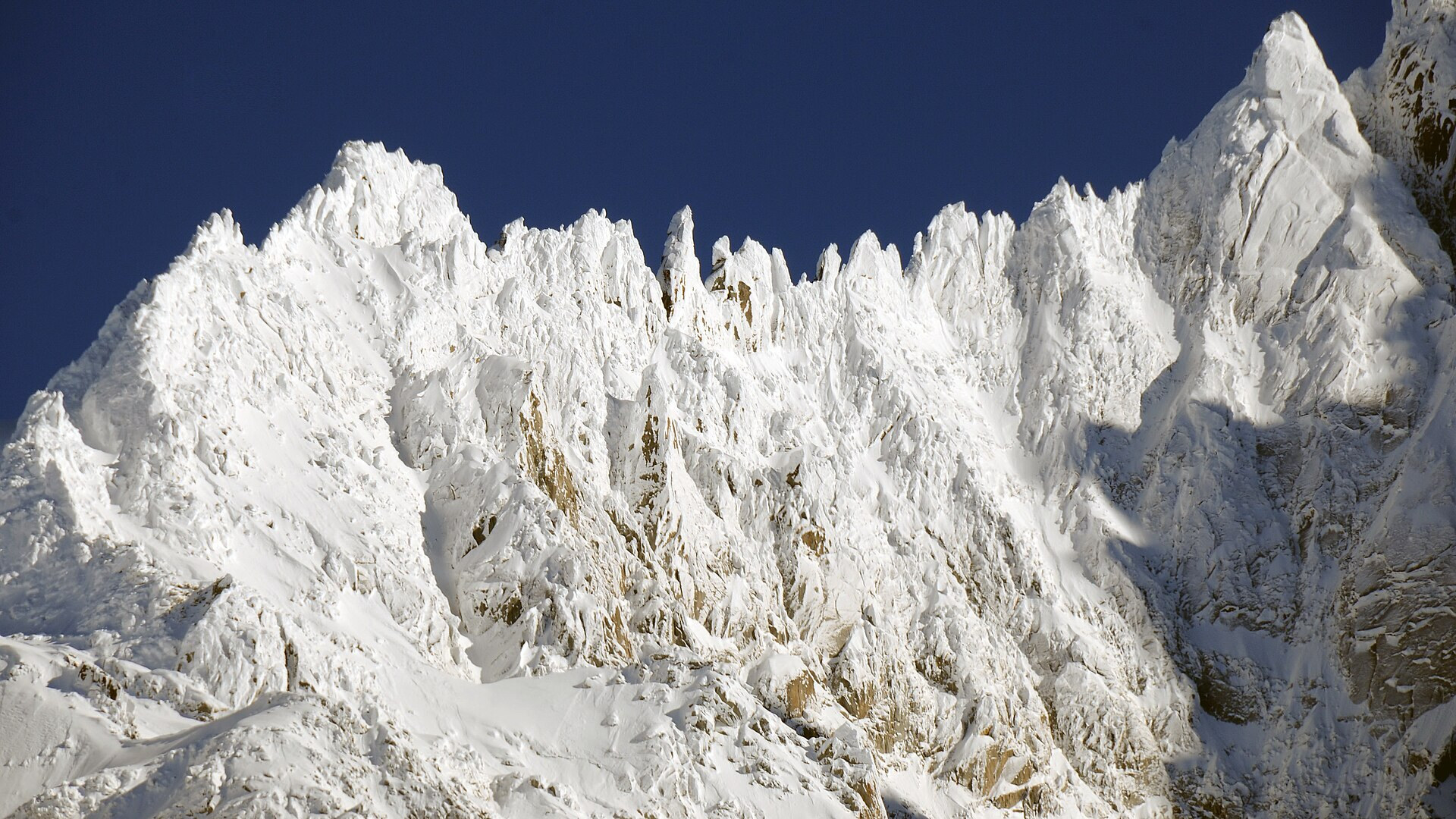
The ridge of the Grands Montets above Argentière, near Chamonix, after fresh snow in January 2016. Photo: Henk Monster via Wikimedia Commons, CC BY 3.0
A series of Atlantic storms starts to bring snow to the western Alps on Sunday 15 November 2026. Forecasters expect up to 1 m of new snow by Thursday 19 November in the high parts of the French Alps, Valais and the Aosta Valley. Until now the snow cover has been thin: in Savoie it started only at about 2,500 m as of 13 November. The storm arrives a week before the first big French resorts plan to open, and it brings strong wind and a snow line that moves up and down.
In short
- SRF Meteo expects up to 1 m of new snow on the western Alpine north side, locally more in the Lower Valais.
- Model tables from Snowplaza give Chamonix about 112 cm and Les Arcs, La Plagne and Courmayeur more than 100 cm by Thursday 19 November.
- The heaviest snow falls from Monday 16 to Wednesday 18 November; the snow line moves between about 1,300 m and 2,500 m.
- Austria and Germany get much less at first: 30–35 cm in Vorarlberg and Oberstdorf in the first week.
- Val Thorens, Tignes and Orelle plan to open on Saturday 21 November.
How much snow, and where
All figures are forecasts made on 13 and 14 November, not snow that has already fallen. They differ by source because each one counts at a different height.
SRF Meteo, the forecast service of the Swiss public broadcaster, wrote on Friday 13 November that up to 1 m is possible on the western Alpine north side and locally a little more in the Lower Valais. Less falls in north-eastern Ticino and in central and southern Graubünden, where the Alps hold back part of the precipitation.
Snowplaza calculated the new snow for each resort at the height of the top station:
| Resort | By Tue 17 Nov | By Thu 19 Nov |
|---|---|---|
| Chamonix (Aiguille du Midi) | 54 cm | 112 cm |
| Argentière (Grands Montets) | 52 cm | 110 cm |
| Les Arcs, La Plagne, La Rosière | 45–50 cm | more than 100 cm |
| Courmayeur | 44 cm | more than 100 cm |
| Tignes | 44 cm | 90–95 cm |
| Nendaz | 41 cm | 89 cm |
| Verbier | 39 cm | 83 cm |
| Vorarlberg, Arlberg | 5–7 cm | 30–35 cm |
Snowplaza also gives a trend to Thursday 26 November, with up to 165 cm for Chamonix. It warns that nobody can yet say whether Chamonix will get 165 or 120 cm. Skiinfo.fr expects 50 to 80 cm at mid-slope in the northern French Alps from Monday to Wednesday and 25 to 45 cm in the southern French Alps. That would be the biggest snowfall of the autumn so far.
The week day by day
The bulletin of chamonix-meteo of Saturday 14 November describes the sequence for the Mont Blanc area:
| Day | Forecast for the Chamonix area |
|---|---|
| Sun 15 Nov | showers in the morning, new storm in the evening; snow from about 1,900 m |
| Mon 16 Nov | continuous, fairly heavy precipitation; 40–50 cm at about 2,200 m in 48 hours; gale from the north-west at altitude |
| Tue 17 Nov | very deep low (960–970 hPa) from west of Ireland to Germany; snow below 1,500 m; strong to gale-force westerly wind |
| Wed 18 – Thu 19 Nov | uncertain; precipitation continues, stormy wind at altitude |
The site estimates 80 to 120 cm at about 2,000 m over the three days to Thursday 19 November and calls the figure uncertain. SRF Meteo expects the Swiss snow line mostly between 1,300 and 1,700 m, with a short jump to 2,500 m on Tuesday.
Wind and danger in the high mountains
The snow comes with wind. Gusts of up to 120 km/h are possible on exposed Swiss peaks, oe24 reported on Saturday 14 November. In Austria, the Außerfern and the Tyrolean Oberland can get up to 60 cm in the high mountains by Thursday, according to a Kachelmannwetter chart in the same report.
The Météo-France office in Chamonix warned that "ça risque d'être assez dangereux en haute montagne" (it could be quite dangerous in the high mountains) in the coming days, especially because of strong wind on Tuesday, France 3 reported on Friday 13 November. New snow on a thin, wet base and strong wind make a poor mix for anyone who goes off the marked runs before the resorts open.
A slow start so far
Before this storm the autumn was dry and very mild at altitude. The Préalpes had no snow cover on 13 November, a Météo-France forecaster told France 3. In the Vanoise, Haute-Maurienne and Haute-Tarentaise the snow cover started at about 2,500 m, and rain had soaked it. A Météo-France forecaster also said that the snow cover at 1,800 m has lost 4 to 8 days per decade since 1950.
The unsettled weather also makes snowmaking harder: it normally needs stable high-pressure weather, a Météo-France forecaster in Isère said. These are the planned opening dates:
| Resort | Planned opening |
|---|---|
| Val Thorens, Tignes, Orelle | Saturday 21 November |
| Val d'Isère | Saturday 28 November |
| Alpe d'Huez | Saturday 5 December |
Chamonix, Les 2 Alpes and Montgenèvre also plan to open in the week after 21 November. All dates depend on the snow.
What this means for your skis
Deep new snow on a thin base is the classic early-season trap: soft on top, rocks close underneath. For the first days on fresh snow, a wider all-mountain ski of about 100–105 mm floats better than a narrow piste ski.
| Ski | Waist | Radius (length) |
|---|---|---|
| Nordica Enforcer 104 Free | 104 mm | 17.5 m (179 cm) |
| Blizzard Rustler 10 | 103 mm | 17.5 m (180 cm) |
| Elan Ripstick 102 | 101 mm | 17.8 m (175 cm) |
The figures are the makers' own; we compare them, we do not ski the products. To find the right ski for your level, use the Pick-a-Ski ski finder.